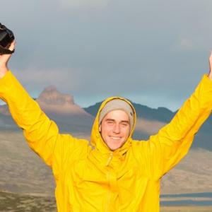
60 km, 2 sections, 4 days and 4 friends on the Nepisiguit Mi'gmaq Trail
The Nepisiguit Mi’gmaq Trail, in Northern NB, is a 150 km (93 mi.) long backcountry wilderness paradise. Starting at Daly Point Nature Reserve in Bathurst, the trail follows the mighty Nepisiguit River up to Mount Carleton Provincial Park.
The trail is an ancient portage route that was used by the Mi'gmaq people as a means to travel from the Chaleur Bay to the highlands of their vast territory, in the Appalachian Mountain Range. Now, hundreds of years later, it has been recommissioned by a great team of volunteers at Sentier Nepisiguit Mi'gmaq Trail.
My 3 friends and I planned to hike 60 km (37 mi.) of this ancient trail in a total of 4 days. 60 was a number that seemed somewhat intimidating, but we were more than ready to take on the challenge to see how we could measure up to this natural wonder.
We planned to do the trail in 2 sections to hopefully get a feel for everything. Throughout its 150 km (93 mi.) there are 3 major geological changes – mountain, river valley, and river delta; by hiking two different sections, we got a chance to experience most of what the trail had to offer without doing the trail in its entirety. (We’ll save the full trail for next time!)
The plan was simple: get 2 cars, drop one off at one access and one at the other, hike from one section to the next and then repeat for section 2.
We started off on Saturday, bright and early – 5am to be exact. The start of our hike was a 2-hour drive from the Bathurst Quality Inn & Suites, so we wanted to get ahead of the game. A few hours later we had one car parked at the Heath Steele Bridge and we were packing our bags in Popple Depot. The wonderful people at the Governors Lodge gave us permission to park one of the cars at their wilderness resort. It was there where we made sure we had everything we needed for the first section of the hike, which would cover 44 km (27 mi.) and span 3 days.
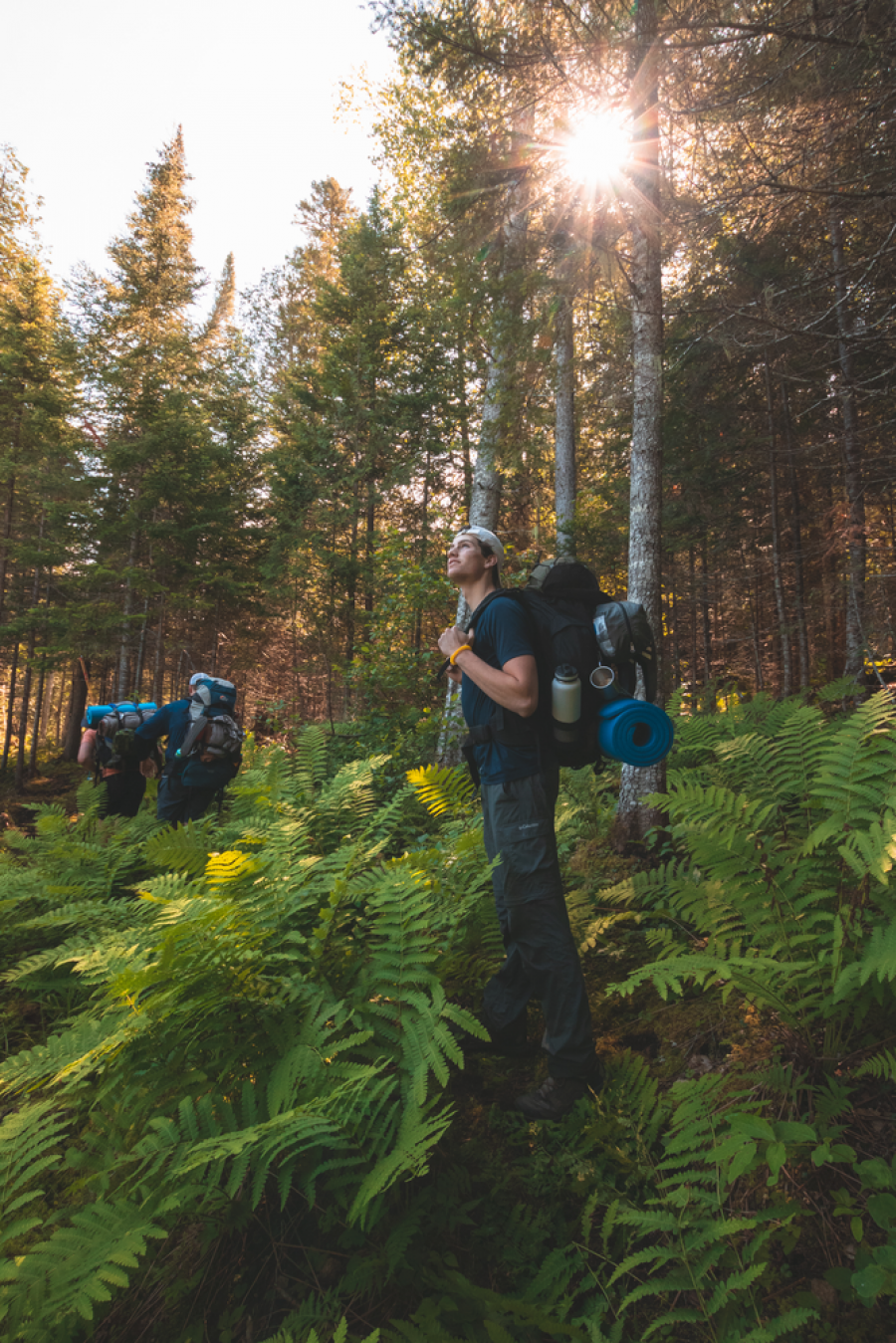
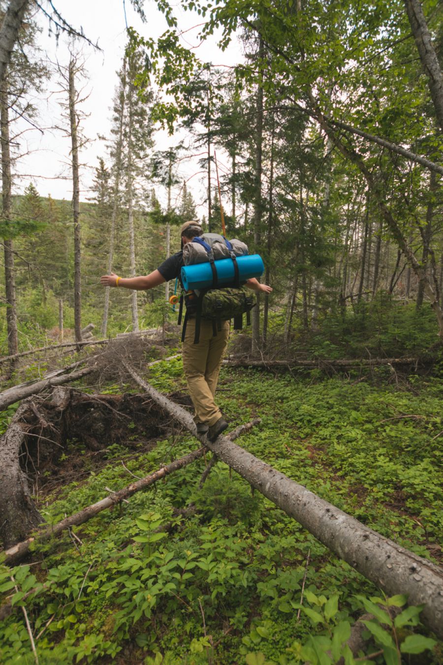
We made it to the trailhead at roughly 8:30am and set out to hike about 19 km (12 mi.) to our first campsite. About a half hour after starting, we ran into a couple of folks with Sentiers verts Chaleur Green Trails. They were off to spend the day fishing and, kindly, took a group photo of us all. Little did we know they would be the last people we would see on the trail the entirety of the trip!
Getting a feel for the trail was an incredible experience for all of us. Surrounded by real, raw and untouched nature is something not everyone gets to experience. Cutting through bush and having to walk across old beaver dams really made it an experience to remember.
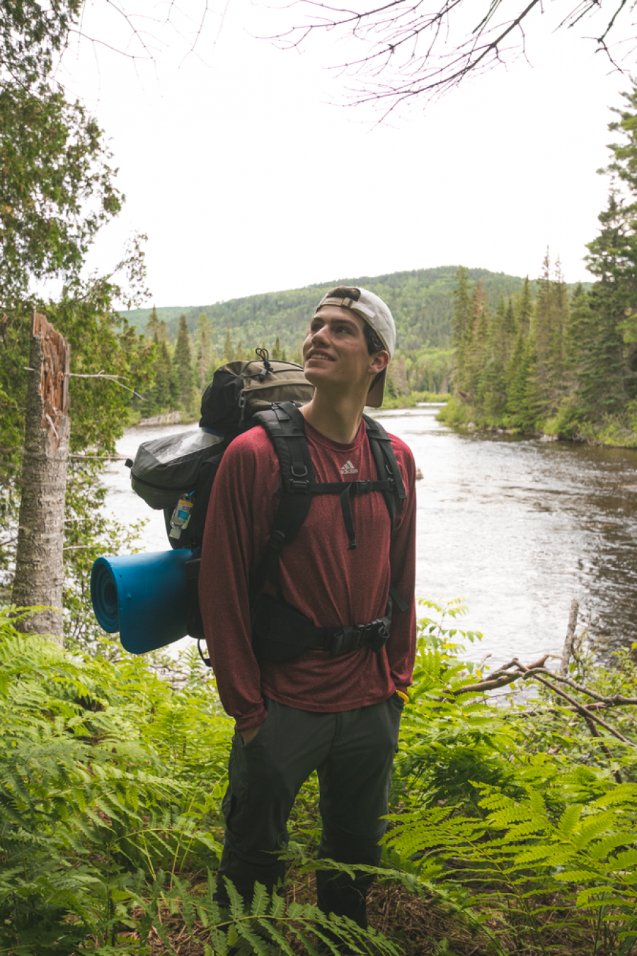
With the river to the left, we encountered many types of terrain. Knobby roots, twigs and forest moss, with the occasional creek crossing, was the view for most of the first day. There were certain sections that were boggy and required some extreme hopping skills. Some of the biggest ferns I have ever seen made their home along the trail. At times, it was like swimming through a sea of green, with the light wind gently brushing the ferns to simulate what seemed like ocean waves. With every opening along the river bends, you could see the rough rolling hills of the rugged Northern NB uplands.
Our first campsite was at Indian Falls Depot, almost 20 km (12 mi.) from where we started in Popple Depot. There was a nice curve in the trail which offered a beautiful view of the river and the steep hills parallel to it. To the south, you could see through the trees to Mount Denys, a prominent peak along the river valley.
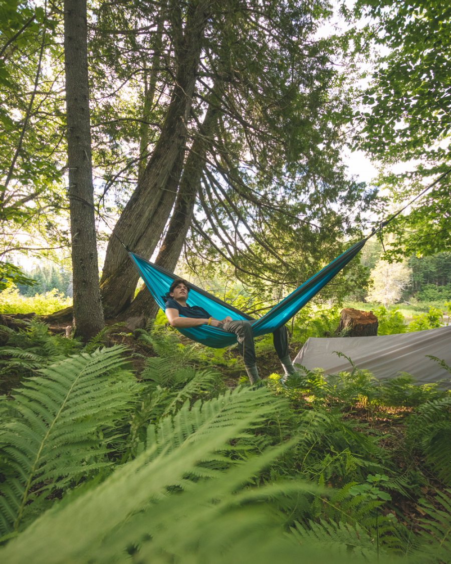
Pepperoni pesto penne topped off our day which made it an easy 11/10. We sat on our mini portable stools and chilled in the hammock while watching the river rush by. As we cracked jokes and talked about our day, it became apparent to us that nothing could top the feeling of absolute freedom we felt at that moment.
The next few days would provide us with many interesting stories and tales to tell. Everyone ended up with their own pace, so it became somewhat of an individual effort. Whenever we found something cool we could admire, we would take a break and chat about how the hike was going. The occasional moose and deer skulls would be conversation starters. It reminded you that nature was always in charge and everything has an expiry date. Snakes, birds, squirrels and bugs were common friends to have at any given moment along the journey. The birds were the best at making the prettiest forest tunes you could hum along with, for the perfect melody. The occasional naughty squirrels would fight right in front of you to make sure you knew who’s boss.
When came time to cross streams, some of the larger brooks had neat suspension bridges built to aid in crossing. Built out of rope, timber and forest logs, it felt as if the bridges were a part of the forest, a pretty awesome experience. We crossed a total of 3 on the trip, which really saved us from getting our feet wet.
On day two of the first section, we passed through “Allens Rocks,” a section of the trail where the once calm river gets turned up by a heap of jagged rocks and crazy currents. The water almost seemed angry from what it was earlier on in the trip. It was a neat change to see the river transform. With every kilometre the river matured, and we were watching it evolve every step of the way. I grew a great respect for it.
About 30 km (19 mi.) into the trip, the river changed yet again. This time, to something much different than before. At this point, the river was very wide and also quite shallow. It went in a thoroughly straight line, for the most part, but there was a slight change in it when we got to a place they call “The Bend.” Here, there was an abundance of white pine, a tree which is noticeably taller from the balsam fir we walked with prior. It was a known sign that we were dropping in elevation.
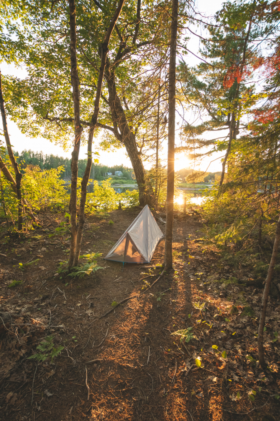
When we started looking for our second chosen campsite of the trip, we were starting to feel the effects that walking 40 km (25 mi.) does to you. The joy and enthusiasm were there, but the legs needed a break! After a few hours of walking, to what ended up being a total of 21 km (13 mi.) that day, we found the perfect spot to set up the tents. There were beautiful ferns, large mature trees and, of course, flat ground. There were many sticks, knots and ferns that were in the way so we figured a bit of house cleaning was in order. After a few minutes the hammock was hung between two pines, the tents were set, and we had a beautiful area with old, fallen logs where we could sit around and chat.
Sunset came on the second night and it swept us off our feet. Mixing with the clouds and the fog, the sun created cotton candy shades of lavender, pink and purple, eventually fading to a soft red glow. With the wind nonexistent, the sounds of the river grew louder and the birds sung their happy songs. All we could do was sit and admire what nature gave us that night. It was a moment of complete tranquility.
The next day was the day we started our second section of the hike. This was the portion of the hike we had saved the least amount of kilometres for. It was our moment to relax, enjoy and think about all the distance we had covered so far. What made this section truly exciting was the camp site. It was the icing on top of the cake. The finale to the whole trip.
The site was a little rocky point that stuck out into the, now, large lake-like river. Situated right in the middle of the point was a teepee known as “Gitpu”, which translates to “eagle” in the Mi'gmaq language. Surrounding the teepee were old oak trees that provided shade from the hot sun. Ancient, pink granite could be found along the shores of the river, along with a few old stumps we used as stools. It was a beautiful place to sit and watch the fish jump. To the right, there was a large, old white pine at the head of an island. On the top appeared to be an eagle with a nest that sat and watched the river below. We realized, then, why the beautiful site was known as Gitpu.
Late that afternoon, we took advantage of the hot day and went swimming. The water was clean and refreshing – the perfect temperature to cool down in.
As our penultimate day neared to a close, it was time to put our cooking skills to the final test. We sat around the teepee, got comfortable and started cooking. Instant mashed potatoes, Mac-N-Cheese, bacon bits, and even more cheese was on the menu. We mixed it all up into one big slurry and divided it amongst ourselves. It was our first time trying what they call “deconstructed pierogies”. Was it the tastiest thing I've ever had? It sure was near the top of the list!
We woke up the next morning and, somehow, it was the last day of the trip. Spirits were still high, however, you could tell most of the boys were ready to head home.
Throughout the 4 days on the trail, we managed to cover a total of 60 km (37 mi.). Witnessing New Brunswick’s raw natural beauty made this one of the greatest adventures, I can recall. Crazy enough, it was in my very home province! The trip gave me a greater respect for nature and, for once, I felt that I wasn't the one who was in charge. Mother nature guided us through the paths of the Mi'gmaq people that have called this river home for centuries. For that, my friends and I were truly grateful.
If you're ever in New Brunswick and are hungry for adventure, we highly recommend checking this trail out. Come prepared by visiting the Nepisiguit Mi’gmaq Trail website and reading this section-by-section guide to the trail. Book your camp sites along the trail on the Provincial Parks Reservation system under the Backcountry tab.