New Brunswick has an amazing diversity of paddling options. Mountain lakes flowing into rivers tumbling towards the sea. Approachable rivers that only require you to steer around the odd rock. Streams and wetlands that meander through the wilderness where you can anticipate around every turn seeing a bear, a deer, or a moose. Extensive sand dunes full of great blue herons, arctic terns, and seals. We also have the world’s highest tides, with challenging currents and ever-changing water levels that have carved out the most spectacular rock formations.
If you don’t have a canoe, kayak or paddle board, there are many small craft rental companies throughout the province that have you covered. If you are looking for a more experiential paddle, there are several tour companies that will provide you with memories to last a lifetime. Here are some suggestions for your next paddling adventure.
Appalachian Mountain Range Region
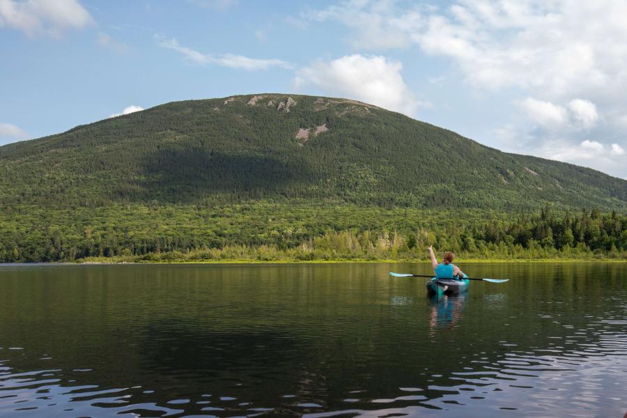
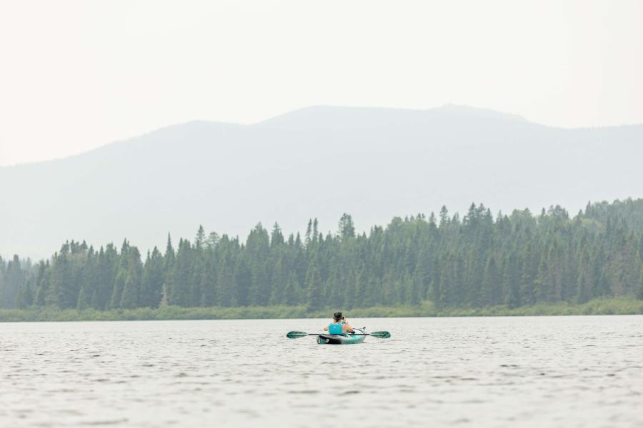
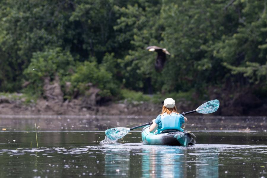
Mount Carleton Provincial Park is nestled in the wilderness of northern New Brunswick. Mount Carleton is the highest peak in the Maritime provinces. Next to it is Nictau Lake to the north and Bathurst Lake to the east, both joined by a Portage Trail. Nictau Lake is accessible from the campgrounds, the lodge and the Nictau Cabins. In the middle of the lake is Visitors Island. The island is a straight drop-off into deep water on one side. On a hot summer day, it is the perfect spot for a refreshing jump into the water to cool off. Look in the trees along the nearby shore and you might see eagles watching you. Check out his video from our last paddling adventure on Nictau Lake.
Bathurst Lake is best accessed from the small parking area at the end of the road, just before the bridge that accesses the Bathurst Lake camps. The bridge crosses a narrow point between Bathurst Lake and Camp Lake. Bathurst Lake is a beautiful paddle with Mount Carleton rising in the distance. If you are looking for wilderness, head into Camp Lake. At the far end is a wide, low beaver dam that cuts across the narrows between Camp Lake and Teneriffe Lake. If you don’t mind getting out and stepping over the dam, you can continue into Teneriffe Lake. On our last visit we came across a cow moose laying in the shallow mud. When we returned to the beaver dam, we were surprised by a large bull moose that popped up out of the water above the beaver dam. Check out these beautiful animals in our video of the adventure.
Two thousand years ago, when canoes were the main mode of transportation, those lakes were a central travel location in the province. They flow into the Nepisiguit River and Tobique River, both of which have their own great paddling options. The Restigouche River is world-famous for its salmon fishing. There you can paddle a single day or a full week. You might consider Chalets Restigouche for an amazing place to stay, as well as shuttles and nearby canoe rentals.
Miramichi River Valley Region
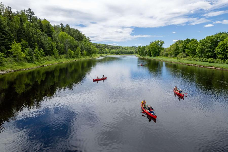
The Main Southwest Miramichi River flows along Route 8 from Boiestown to the City of Miramichi. A popular canoe run is from the Priceville Footbridge near Boiestown to the Route 8 bridge in Doaktown. Logistics is always a consideration when running rivers. To make it easy, Storeytown Cottages near Doaktown offer canoe rentals and shuttle services. The shuttle services are available even if you bring your own canoes. They also have amazing cabins and rooms to rent overlooking the river. If you continue past Storeytown Cottages to the bridges, make sure you stop and visit the Atlantic Salmon Museum. At the museum look for a picture of George Donald. That’s my grandfather!
If you are an avid paddler and feeling more adventurous, you can head further up the river to Half Moon put-in on Route 107 near Deersdale. From here you will have a two-day paddle through the wilderness to get back to Boiestown. May long weekend is the best time for this run since the water is usually too low in the summer.
The Miramichi River watershed has so many tributaries. Another great option is the Northwest Miramichi. A short drive from Wayerton on Route 430 will yield a long paddle out around the wilderness and back to Wayerton.
All tributaries flow into the City of Miramichi where the main branches meet at the Tickle. The Tickle is a narrow passage that separates Wilsons Point from Beaubears Island. Both locations have a rich history you can explore. Beaubears Island is a national historic site where you will find remnants of its shipbuilding past. You can paddle around Beaubears Island by starting at the Wilsons Point wharf or the boat launch at Beaubears Island Interpretive Centre in Nelson. Make sure you stop at the wharf on the northeast side of the island and check out the historic site on the island. The large white pines on the island were used for ship masts. Eagles now enjoy their high branches.
Wolastoq (Saint John) River Valley Region
There are two main features of the Lower Saint John River Valley Region that make it an amazing paddling destination. The main river is the obvious one. The countless lakes to the south of the river that offer amazing paddling adventures is the less obvious one.
There are great boat launches in the cities and towns along the river. These include Nackawic, Fredericton, Oromocto and Gagetown. In Nackawic, the river is wide with very little current and feels more like a lake, so make sure you consider the wind conditions. The boat launch is next to the World’s Largest Axe and not far from the Big Axe Brewery. Paddling between the two is a pleasant jaunt.
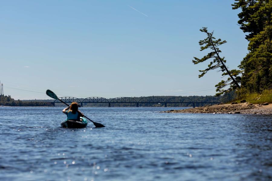
The character of the river changes after flowing through the Mactaquac Dam. The current picks up, and it can make for a fun paddle down along the islands to Fredericton. The McKinley Ferry Boat Launch, just below the fish hatchery, makes a great starting point. This area is full of eagles that come for the salmon that get stopped by the dam. On our last paddle in this area, we saw 50 eagles at one time. It is an 18-kilometre paddle to get to Fredericton. For a shorter paddle along the islands there is a new boat launch in Douglas between 1311 and 1315 on Route 105.
There are many city and wilderness options around Fredericton and Oromocto, such as the Nashwaak in Fredericton and Thatch Island in Oromocto.
Below Oromocto there are 13 steamboat wharves maintained by the Saint John River Society, and several others maintained by municipalities. These wharves make great places to access the river. Steamboats were the main mode of transportation between Saint John and Fredericton for about 150 years starting in 1816. Colwells Wharf and Queenstown Wharf are our favourite launches since they offer the most paddling opportunities.
I also mentioned the lakes in the region. There are so many; here are just a few to give you adventure ideas. West of McAdam we have Spednic Lake Park, which is part of the St. Croix River Watershed. It has a main campground by Spednic Lake but also many campsites on islands and remote shorelines. It truly is an underrated paddling mecca in the province. The North Lake area has wilderness camping options on a peninsula in the lake and provides great paddling itineraries, including Hay Brook and Monument Brook.
Davidson Lake, Lake George, and Harvey Lake all have boat launches. Make sure you follow Clean, Drain, Dry principles so that you don’t accidentally introduce the invasive Eurasian Water Milfoil into these lakes from the Wolastoq (St. John) River. French Lake and Sunpoke Lake in the Oromocto Watershed are also great canoeing and kayaking playgrounds. These lakes are surrounded by meadows, making them a unique paddling experience, but be warned. Dock spiders cover the area in the late fall (for more on that, check out our Sunpoke Lake page). If you are not a spider person, you may want to find another paddling option for this time of the year.
Acadian Coastal Region
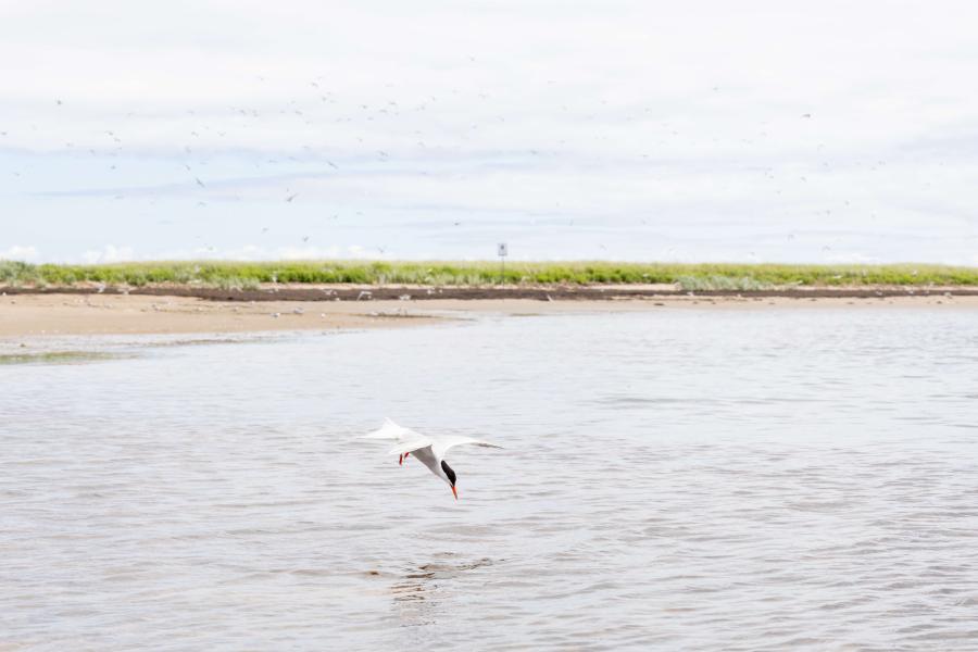
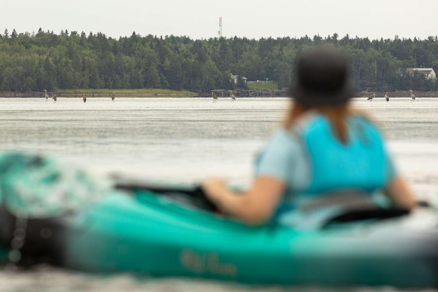
The Acadian Coast offers endless approachable kayaking options. The coastline is protected by extensive sand dunes all the way from Tracadie-Sheila to Shediac. These dunes provide protection from the Gulf of St. Lawrence and the Northumberland Strait. Tracadie Dune, Neguac Dune, and Kellys Beach Dune at Kouchibouguac National Park are a few of the largest, each between 6 and 10 kilometres long. The water is quite shallow behind the dunes. At low tide the water is only a few inches deep and you may have to get out and walk. Environmental protection makes the dunes a great place for wildlife viewing. On our last paddle at the Kouchibouguac Lagoon we could see more than 20 Great Blue Heron hunting in the shallows. We also saw lots of cormorants, mergansers, and Arctic Terns diving in the water and catching fish. Saint-Louis Lagoon at Kouchibouguac National Park has a tern colony on one of the islands and a seal colony at the end of Kellys Beach Dune. Watch the video from my paddle to see them.
If you are an experienced sea kayaker, you can venture out beyond the dunes. Most of the rest of this coastline are peat cliffs, which are very interesting. These dark spongy cliffs surround Lamèque and Miscou Islands, Neguac and Tracadie, and Escuminac point at the mouth of Miramichi Bay.
Fundy Coastal Region
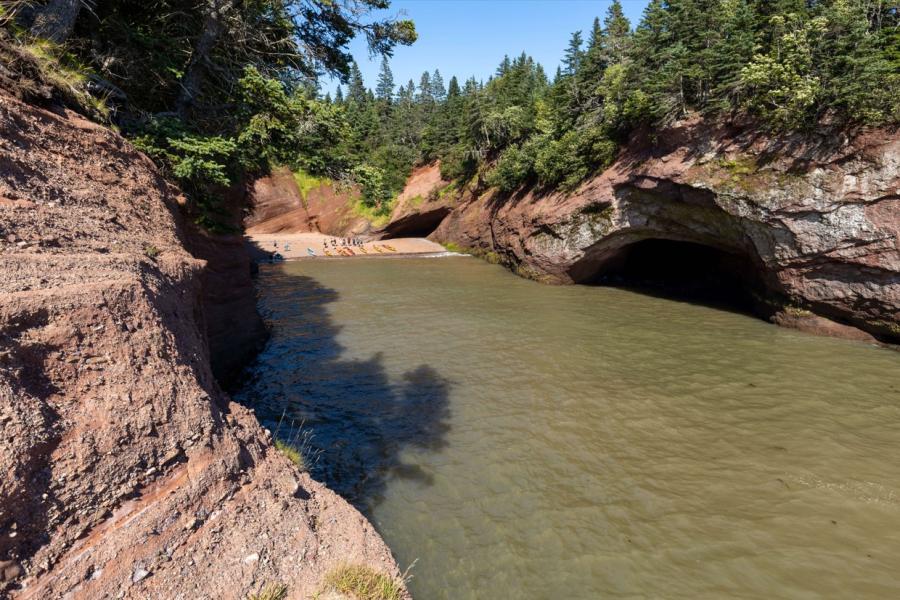
The Bay of Fundy has the highest tides in the world, which result in the most challenging conditions for paddling. Experienced paddlers seek out local information about routes and currents created by the extreme tides. If you don’t have a lot of experience, you might want to take a tour. You can find a map of boat rental and tour companies on our Get Started page. The three main tour companies along the Fundy Coast are Baymount Adventures in Hopewell Cape, Bay of Fundy Adventures in St. Martins, and Adventure High on Grand Manan Island.
Baymount Adventures focuses on exploring Hopewell Rocks. Hopewell Rocks Provincial Park is the best place to see the extreme tides in the Bay of Fundy. At low tide you can walk on the ocean floor around giant flower pot rocks, then at high tide you can paddle around them on one of Baymount Adventures’ kayak tours.
Bay of Fundy Adventures provides several kayaking tours from St. Martins. From here you will get to explore sea caves that were carved by the tides. There are also large, unique cliffs. A longer paddling adventure takes you along the coast of Fundy Trail Provincial Park where you will find several more interesting rock features and gravel beaches. They also have tours on the Fundy Isles several times a year.
Another option for tours on the Fundy Isles is Adventure High on Grand Manan Island. They offer different length tours around the island and several multi-day tours to nearby islands. Grand Manan Island is a geological split with low sandy shoreline to the east and high, rocky spire cliffs to the west.
If you’re visiting Fundy National Park, you can also consider renting kayaks from Outdoor Elements at Bennett Lake. This small lake is a great option to get kids out on the water. You may see loons, grebes or other wildlife on the lake.
As you can see, New Brunswick has very diverse paddling adventures. You can explore sand dunes, peat cliffs, flowerpot rock formations in the highest tides in the world, wilderness lakes and river, and historic locations from when waterways formed the main travel corridors of the province. We love exploring all these amazing locations, and hope this inspires you to plan your own epic paddling adventure.
For a more comprehensive list of paddling routes in the province, along with videos, photos and details, check out the Paddling NB website. There are currently 52 routes on the site, and we are adding about 10 more each year as we continue to explore this beautiful province.