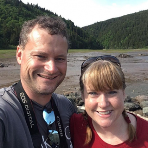
Hiking NB bloggers James and Vicki Donald share their insights on New Brunswick’s long distance, multi-day hikes.
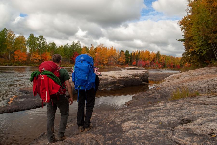
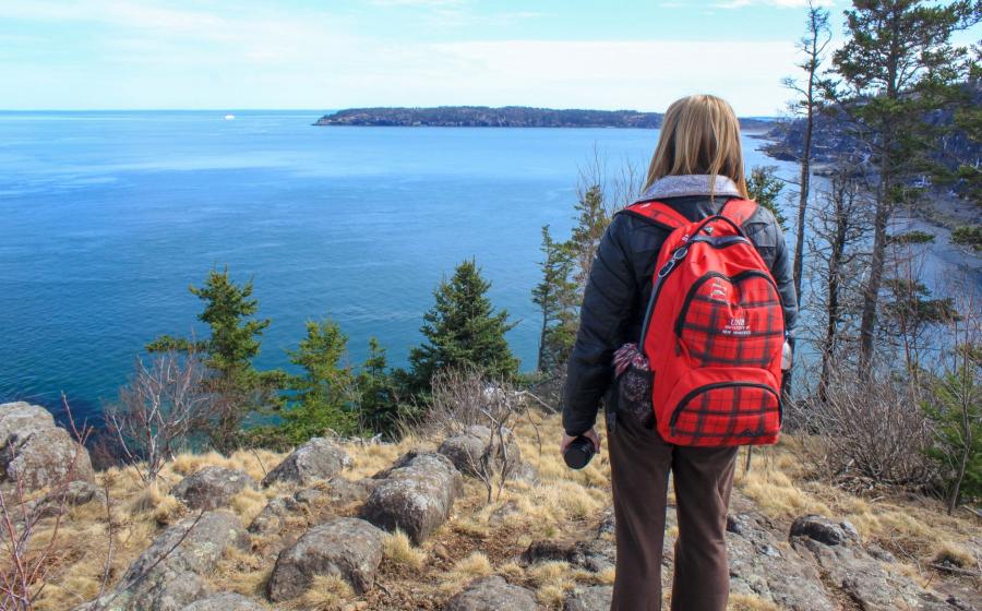
When we first started hiking, I was told to be careful because backcountry camping and hiking long distances can be addicting. That was good advice. When you go on a day hike, you immerse yourself in the wild for short bursts. When you stay out in the wilderness overnight you get a full sense, and a whole different view, of the place. From watching the lights of fishing boats travelling up and down the coast in the moonlight along the Fundy Footpath, to waking up early and having breakfast with two beavers on the Nepisiguit Mi’gmaq Trail; these are experiences you don’t get with day hiking.
Nature changes your brain and there has been a great deal of research over the past few years that says it takes about three days to get the full benefit of this change. This is when you get all the noise out of your head and become fully engaged with this new environment. Your blood pressure drops, you become more focused, and you have fewer of those negative repetitive thoughts. You start to get into the rhythm of your steps. It’s a primal feeling and it is why so many people choose to head off on long trails every year.
To help inspire you and get you started on planning your next long trail adventure, here are some stories and information on the long trails in New Brunswick.
1. NEPISIGUIT MI’GMAQ TRAIL
- Length: 141 km (88 mi.)
- Difficulty: moderate
- Access: gravel road access at several points
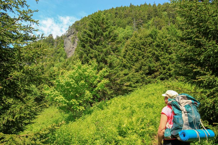
Hundreds of years ago, before there were planes, trains and automobiles, waterways served as the travel corridors for anyone exploring the province. The main mode of travel was by canoe and on foot across portage trails between waterways. The Nepisiguit Trail is the best example of one of those old travel routes. The trail took First Nations people, and later European settlers, from Chaleur Bay in Bathurst, all the way across the province to Mount Carleton. Mount Carleton Provincial Park not only boasts the highest peak in the Maritimes, but it is also the headwaters of three main river systems: the Tobique, the Upsalquitch, and the Nepisiguit. This made it a critical hub for travelling around the province.
The Nepisiguit Mi’gmaq Trail is a representation of this travel corridor. It follows the Nepisiguit River through the wilderness of northern New Brunswick. Today it joins Daly Point Nature Reserve on the shores of Chaleur Bay to Bathurst Lake at Mount Carleton Park. Even though the trail travels through some of the most mountainous areas in the province, it is relatively flat as it follows the river valley the whole way.
If you are not ready to hike the whole trail in one go, there are several main access points along the trail. These bisect progressively longer sections of the trail as you get closer to Mount Carleton Park. There are also several access points in between but the majority of them require river crossings. These get progressively shallower as you move towards the headwaters. If you are planning on using one of these access points, you should find out about water levels and temperatures. Having frozen feet is a hard way to start and end any hike.
The first wilderness section of the trail, from Rough Waters to Middle Landing, is 20 km (12 mi.) The next section, from Middle Landing to Heath Steel Bridge, is 30 km (19 mi.) These are perfect to get started but are also the busiest. The sections also get progressively wilder as you get closer to Mount Carleton Park.
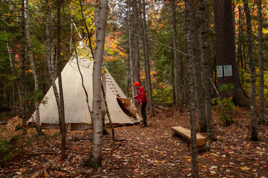
The trail passes by amazing scenery including Pabineau Falls and the surrounding peaks near Mount Carleton. There are campsites with shelters, tenting platforms, and a few of the sites even have teepees. The large teepees make unique camping accommodations. The trail is maintained by volunteers so consider donating to the Nepisiguit Mi’gmaq Trail to show your appreciation for the amazing job they are doing.
For more information on the trail go to the Nepisiguit Mi’gmaq Trail page on Hiking NB.
2. INTERNATIONAL APPALACHIAN TRAIL – NEW BRUNSWICK SECTION
- Length: 297 km (185 mi.), including 136 km (85 mi.) on paved roads
- Difficulty: easy
- Access: paved road access at several points
The International Appalachian Trail (IAT) is an extension to the famous Appalachian Trail. The IAT extends through northern Maine, across northwestern New Brunswick, and into the Gaspé Peninsula in Quebec. There are even parts of it in Europe where there are still remnants of the Appalachian Mountain range from millions of years ago when the continents were all joined. The IAT in New Brunswick travels through the most mountainous region of the province including Mount Carleton Provincial Park.
Over half of the trail in New Brunswick travels along old rail beds converted into multi-use trails. The section from Plaster Rock to Saint-Quentin, passing by Mount Carleton Park, is on paved roads. There are no designated campsites or amenities along the trail until you get to Mount Carleton Provincial Park.
The first sections of the trail travel first along the Aroostook River, then the St. John River to Perth-Andover, and continues northeast along the Tobique River to Nictau. The next section of the trail travels for 35 km (22 mi.) through the wilderness of northern New Brunswick to Mount Carleton Park. There are no supplies or services along this part of the trail and only minimal services at Mount Carleton Park (in season). It’s another 35 km (22 mi.) to Saint-Quentin where you will find supplies and services. North of Kedgwick the trail once again travels through the wilderness, this time on an old rail bed down through the Grog Brook Valley. The surrounding hills make this the part of the trail with the most spectacular views.
The trail crosses the Upsalquitch River, and then after another 20 km (12 mi.) in the wilderness, you will come out at Tide Head on the shores of the Restigouche River. A short distance on the pavement along the river will take you to the crossing into Quebec at Matapédia.
For more information on this section of the IAT check out the following map.
3. DOBSON TRAIL
- Length: 58 km (36 mi.)
- Difficulty: moderate
- Access: paved road access at several points
This trail starts on Pine Glen Road on the outskirts of Riverview and travels through the woods of Albert County to the border of Fundy National Park. First following the beautiful Mill Creek, the trail passes several large bogs along Mill Creek. It can be hiked in any season but can be quite wet in the spring. Make sure you bring bug spray. The mosquitos can sometimes be quite thick along this section. You may also encounter areas where busy beavers have flooded the trail. Volunteers do a great job of repairing or rerouting the trail when necessary.
The trail crosses six roads on the way to Fundy Park so it is quite easy to section hike. There are also several nice access trails that are worth checking out. The access trails alone are long enough to make great day hike options.
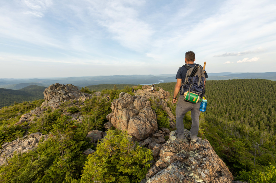
Once you pass by route 910, you will be following a beautiful hardwood ridge above a large, wide valley. The trail passes by the Prosser Ridge Lookout before dropping down to the Prosser Brook Road. The lookout is the best view on the trail and can make a great day hike option from Prosser Brook Road. The trail then climbs once again to some beautiful hardwood and softwood stands. Here you may start to hear strange sounds through the trees. Openings will reveal the large wind turbines in the area. If you are ambitious enough, or just section hiking the trail, check out the Hayward Pinnacle side trail. This trail takes you to a small mountain with a rocky peak. This is the highest point in the area, but you will have to stand on a rock on your tiptoes to see out over the bushes.
The rest of the trail to Fundy National Park passes by a lake and a beaver pond and travels through several different forest types. Continue into Fundy National Park on the extension trail and you will come to the beautiful Laverty Falls.
The trail is relatively flat with some ups and downs but nothing too steep or long. Campsites are very rudimentary with no services. Once you are past the first four kilometres from Riverview you are on your own. If you are looking for a multi-day wilderness adventure, or just a really nice day hike close to the greater Moncton area, this trail is highly recommended.
The trail is maintained by volunteers so consider donating to the Fundy Hiking Trail Association to show your appreciation for the amazing job they are doing.
For more information on the trail go to the Dobson Trail page on Hiking NB.
4. LIGHTHOUSE TRAIL ON GRAND MANAN
- Length: 40 km (25 mi.)
- Difficulty: strenuous
- Access: paved road access at several points
This trail is called the Lighthouse Trail for good reason. It starts at Swallowtail Lighthouse on North Head and ends at the Southern Head lighthouse. It also passes the Whistle Lighthouse on the northern tip of the island. As the fog lifts from the waters of the Bay of Fundy, make sure you look around. From the clifftops you can see the coastline of Grand Manan Island and smell the salt water air. You may hear the whales out in the bay before you see them.
This trail travels along the clifftops overlooking the Bay of Fundy and passes by some of the most interesting geology. Grand Manan is geologically split down the middle. The trail travels around the west side of the island, which has volcanic origins. This history results in the black cliffs and lava spires that you find there today. The east side of the island had a more sedimentary history and is where you will find all the beaches. The east side is also where you will find most of the roads on the island due to the flatter terrain. Even though the Lighthouse trail is more remote on the west side of the island, there are several access trails and roads that cross the island, the main one being the road to Dark Harbour.
Some of the amazing things you will see on the trail are the Hole-in-the-Wall rock formation, the Nine Days Work Cliffs, Eel Brook Falls, Dark Harbour, Hay Point, the black spire cliffs of Southern Head, and the Flock of Sheep rock formation. You will also get a feel for the fishing culture of the island around Whale Cove and a glimpse into Grand Manan’s world-famous dulse industry at Dark Harbour.
There are no serviced campsites or shelters along the Lighthouse trail. There are places along the trail that people frequently use for campsites. Be cautious of the potential risk of wind on the exposed clifftops. The trail travels along the front of private property in many places. Be aware of your location and don’t camp on private property.
If you want to experience a long coastal hike with spectacular views, amazing geology, and a taste of island life, you should check out the Lighthouse Trail on Grand Manan. A 90-minute ferry ride will transport you to another world where there is a strong possibility you will spot whales while you are hiking.
For more information on this trail go to the Lighthouse Trail Page on Hiking NB.
5. FUNDY FOOTPATH
- Length: 64 km (40 mi.)
- Difficulty: strenuous
- Access: difficult access at several points
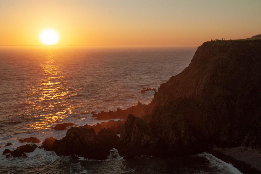
The daily rhythm of many coastlines is driven by the tides. There is no place where this is truer than around the Bay of Fundy. The Bay of Fundy has the highest tides in the world. Around the Fundy Footpath the tides rise and fall 12 metres (40 feet) twice a day. That is around seven of you stacked on top of each other. It amazes me every time I think about it, and even more when I get to experience it.
The Fundy Footpath travels through 53 km (33 mi.) of coastal wilderness from the Big Salmon River Visitor Centre at the Fundy Trail Provincial Park to the Point Wolfe parking lot at Fundy National Park. If that’s not enough you can continue on the Coastal Trail at Fundy National Park to the visitor centre. That will add another 11 km (7 mi.) of amazing views to your trip. The trail is rugged and strenuous as you climb in and out of many tidal valleys. You have to time your hike so that you make the tidal crossings near low tide. If you miss the crossing, you may have to wait for up to six hours for the tide to change. Each climb out of a river valley is usually 200 metres (600 feet) and the cumulative elevation gain is equivalent to climbing a mountain that’s over 3,500 metres (10,000 feet). Remember that you will have a 13 to 18 kg (30 to 40 pounds) pack while climbing these hills so pack lightly.
There are several access trails that can be used to section hike the trail, but they are at the end of forestry roads deep in the woods to the south of Sussex. Either a knowledge of the area or map skills will be required if you plan to use the access trails.
The difficulty of this trail is more than made up for by the amazing beauty and the interesting historical remnants. Several places along the trail were full villages over 100 years ago. These villages were built up around the forest industry. If you know where to look you will find old dams, boilers, kilns, the foundation of an old lighthouse, telegraph lines, a mine, and sawdust piles from old sawmills. The geology along this trail is variable and fascinating. The gravel bar that joins Martin Head to the mainland is huge. There are also fossilized sand dunes, countless cliffs and cracks, extensive mudflats (the trail goes around them), the giant boulder called Dragon's Tooth, and several waterfalls.
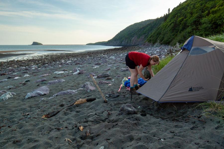
There are many primitive campsites along the trail. Most of them are in river and stream valleys. Some have pit toilets and the main ones have bear hangers just in case. We have never seen any sign of bears, but we have had several midnight run-ins with persistent mice so we recommend you don’t store food in your tent.
The trail is maintained by volunteers so consider donating to the Fundy Hiking Trail Association to show your appreciation for an amazing job they are doing.
If you are looking for an amazing and challenging hike that will get you in the rhythm of the phenomenal tides of the Bay of Fundy you have to check out the Fundy Footpath.
For more information on the trail go to the Fundy Footpath Trail page on Hiking NB.
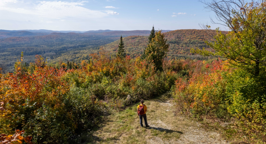
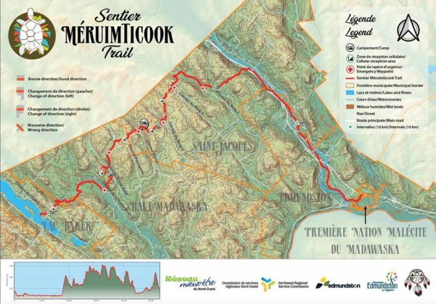
6. MÉRUIMTICOOK TRAIL
- Length: 50 km
- Difficulty: Difficult
- Access: variable access points throughout the trail
The Méruimticook Trail is the newest long trail being developed in the province. The trail starts at the Madawaska Maliseeet First Nation, travels through the City of Edmundston, and then along the Madawaska River Valley. Before reaching the Quebec border it turns and climbs out of the river valley and into the woods. The trail continues through the woods all the way to Baker Lake. Future plans are to extend the trails another 50 kilometres to Glazier Lake on the US/Canada border.
The trail climbs up over five hills and down through five valleys on the way to Baker Lake. Each of the valleys has a road that can be used to access the trail. This allows for many day hike options. The second last hill has an amazing lookout to the west. The trail then drops down into the last valley and crosses a bridge over Baker Brook. From the bridge are amazing views of the surrounding hills. After following an ATV trail through the river valley, the trail splits. From here you can continue left on the ATV trail or turn right for a forested trail along the river. I recommend the forested trail. The forested trail passes by a bench next to a large pine tree overlooking Zaie Falls. A great place to take a break before climbing over the last hill to Baker Lake.
For more information on this trail go to the Méruimticook Trail page. For updates on the trail check out their Facebook page.
We are off to find our next adventure – now go find yours! We hope to see you on the trail.
🚶 🚶 🚶