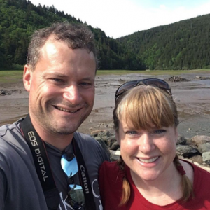
Hiking NB bloggers James and Vicki Donald share their favourite spots for hiking on the Acadian and Fundy coasts.
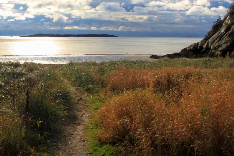
From the cobblestone beaches on Campobello Island, along the lava spires of Grand Manan Island, across the rocky shoreline of the Fundy Footpath, to the sandy beaches along the Northumberland Strait, it is not hard to see that New Brunswick has a diverse coastline to explore. We feel the best way to explore this coastline is by taking a hike, but we may be biased. Now get your boots and let’s go on an adventure!
To point you in the right direction, here are our top 12 recommendations for coastal hiking trails:
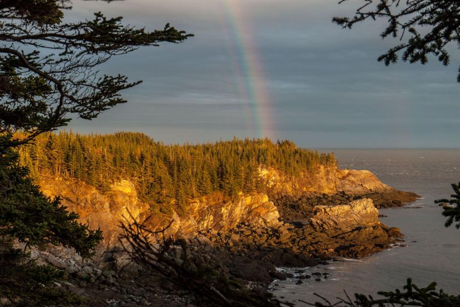
1. FUNDY FOOTPATH
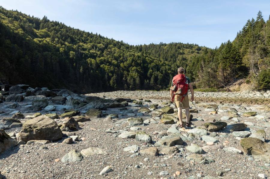
This challenging, 64-km (40 mi.) wilderness trail hugs the coastline from Big Salmon River to Fundy National Park.
Feel your legs burn as you crest yet another hill and travel across a plateau through a moss-laden spruce forest. Descend the next hill and emerge onto a tidal beach where you consider pitching the tent for the night. Look back along the jagged shoreline as the waves crash on the rocks and the mist rises along the hills. One hundred years ago this trail was a cart path. People laboured up and down these steep hills to reach the bustling communities at each river and stream crossing. If you know where to look, you can find remnants of that bygone era. If you didn’t know any better, you would think this has been wilderness since the beginning of time.
Time stands still as you realize that you are at least 20 km (12 mi.) from the nearest inhabitants. You quickly come to the realization that you again must climb the next 200-metre (656-ft.)-high hill and wish you had packed a lighter pack. You consider just camping here for the night, but this is a five-day hike and you are already on day three. The hills just keep coming. Before you start your climb, you look back over your shoulder at this amazing place and fill your lungs with the salt water air. Then you begin to climb.
The Fundy Footpath can be accessed from Fundy National Park, or from the Fundy Trail Provincial Park, near St. Martins.
2. LIGHTHOUSE TRAIL IN GRAND MANAN
The Lighthouse Trail is one of the long trails in the province but it can easily be broken up into day hikes. Start your adventure at Southwest Head Lighthouse and hike along the grassy plateau on the cliff tops. The jagged cliffs are formed by ancient lava spires. Pass by Dark Harbour and see where the locals harvest and dry dulse, a unique seaweed delicacy. As you reach the northern tip of the island you see the Whistle Lighthouse, which you may have seen on your ferry ride to the island. Pass by the Hole-In-The-Wall formation, a rocky arch that reaches out and dips into the ocean like a giant’s finger. This is only a few of the many fascinating things you will see along this multi-day hike around Grand Manan Island.
3. BOUCTOUCHE DUNE
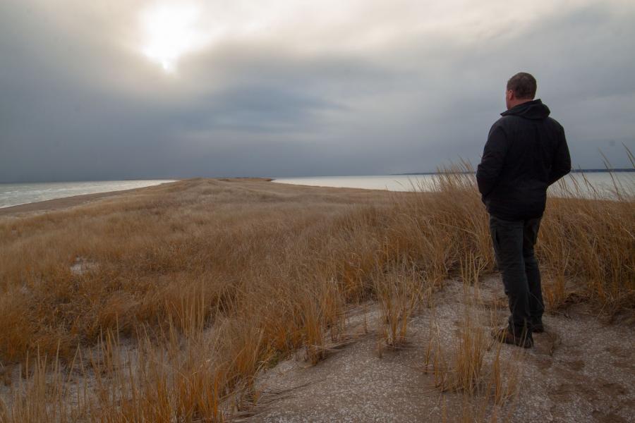
When most people think of wild, they usually aren’t thinking of a sand dune. Bouctouche Dune is different. When you walk on the dune for 12 km out into the Northumberland Strait all the way to the lighthouse at the very tip, it starts to feel very wild. If you are as lucky as I was, you will run across a gray seal lounging on the beach. He was surprised to see me in this remote place where there are few humans. Shorebirds run along the endless beach and the grassy dunes stretch all the way to the horizon and beyond.
If you are not ready for a 12 km (7.5 mi.) hike, you can walk out to the end of the one-km boardwalk that meanders through the dune. Stop into the Irving Eco-Centre visitor centre and find out all about the ecology of the dunes. The lookouts near the visitor centre give you a sense for the environment and provide access to the beach. But if you are looking for wilderness, step off the boardwalk and just keep walking.
4. ECOLOGICAL PARK OF THE ACADIAN PENINSULA IN LAMÈQUE
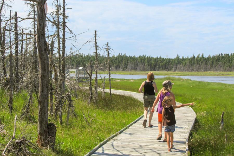
Climb the tower near the entrance and look out over the saltwater marsh lined bay. Can you spot any Great Blue Herons wading in the water, or Arctic Terns floating on the breeze? Cross over the 300 m (984 ft.) boardwalk while looking for ducks or other shorebirds. When you enter the woods make sure you check out the Arboretum Trail. It hosts 27 trees that are native to the area. Continue on the main trail and you will soon come out onto another boardwalk that follows along the grassy shores of the bay. Learn about nesting ospreys and make sure to look up to see if there are birds on the nesting poles. Make sure to read the signs while exploring the trails of the Ecological Park to get more information on this fascinating ecosystem.
5. CAPE JOURIMAIN NATURE CENTRE
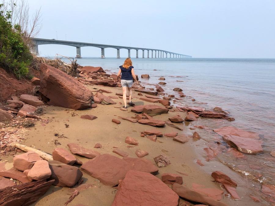
The views of the Confederation Bridge, the history, lighthouse, sandy beach, hiking trails, interpretive centre and several lookouts are all the things that will distract you from the true purpose of the Cape Jourimain Nature Centre. Cape Jourimain was designated as a National Wildlife Area in 1980. The Wildlife Area includes several very large saltwater marshes that surround Trenholm and Jourimain Islands. Go beyond the many attractions on the Trenholm Trail to find the heart of this nature reserve.
Check out the nesting osprey near the start of the Trenholm Trail before crossing the causeway overlooking an extensive salt marsh. Look for Great Blue Herons and the many species of ducks in the grasses of the marsh. Continue around Trenholm Island and watch for songbirds in the trees, before coming out to the many lookouts that overlook the endless salt marsh. Spend time at these lookouts and see how many of the different birds you can identify.
Find more information on Cape Jourimain trails on the Hiking NB trails page.
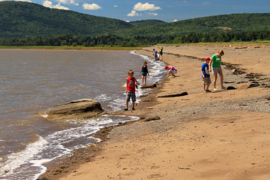
6. NEW RIVER BEACH PROVINCIAL PARK
As the tides rise and wash away the elaborate sand sculptures at the Sand Sculpture Competition in July, the beach disappears. When the beach is under water, it’s time to go for a walk along the rocky coastline. Make sure you slow down and explore the small gravel beaches on the way to Chitticks Beach.
Sit on the beach and look out over New River Island as you imagine the Chitticks’ homestead that stood on this site more than 150 years ago. It would be a beautiful place to live but would have been a difficult place to survive.
Continue to Barnaby Head where you will find a very rough and rugged coastline with the hilly trail continuing along the top. Feel the sea spray in the breeze as the waves crash on the rocks below. A boardwalk meanders through a large bog before you make your way back through the forest to the parking lot. With several interesting trails, the New River Beach Provincial Park is much more than just a beach.
7. HAY ISLAND PARK IN NEGUAC
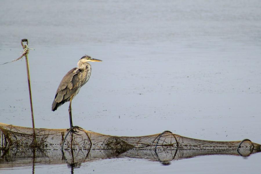
Roll your windows down and breathe in the smell of salt water while driving across the causeway to the small, sandy island of Hay Island Park. Pull over at one of the wide spots and look for herons and other waterfowl and shorebirds along the shores. On our last visit a Great Blue Heron was standing on top of a fishing net near the road as if he was posing for a picture. Drive across a small bridge and soon you will be travelling through the forested island. A beautifully painted blue, white and red Acadian lighthouse will soon emerge from the trees on the right.
Leave your vehicle at one of the parking lots and take a walk along the shore and out to a sandbar. The sandbar makes a great beach. There is a boardwalk that loops around a small marsh near the lighthouse. The trail along the shore provides many views of the outer Miramichi Bay. Look for wading birds in the marsh. There is so much to explore on such a small island. Get trail maps and more details on the Hiking NB trail page.
8. IRVING NATURE PARK IN SAINT JOHN
As you drive down the hill and see the road extend between a sand beach and large saltwater marsh, you will find it hard to believe you are still in the city of Saint John. Park your car at the end of the beach and climb the hill to the cliff tops where the trail begins. After about a kilometre of hiking, you will go around a point that juts out into the bay. This place feels even more remote as the point cuts off your views of Saint John. At this point the lookouts focus on the uninhabited Manawoganish Island in the bay. A steady parade of oil tankers on the horizon are all that’s left to remind you that you are still in the city.
Head inland away from the rocky shoreline and keep an eye out for the many deer that roam around the Peninsula. Make sure you also look up. You may come face to face with the many porcupines that occupy the forest.
End your hike by walking on the long boardwalk out onto Saint’s Rest Marsh. The Fundy tides change this landscape drastically every 6 hours, from grassy wetlands to sweeping mud flats.
In addition to its coastal trail network, the Irving Nature Park offers interpretive programs and activities that are great for the whole family.
9. MINISTERS ISLAND IN SAINT ANDREWS
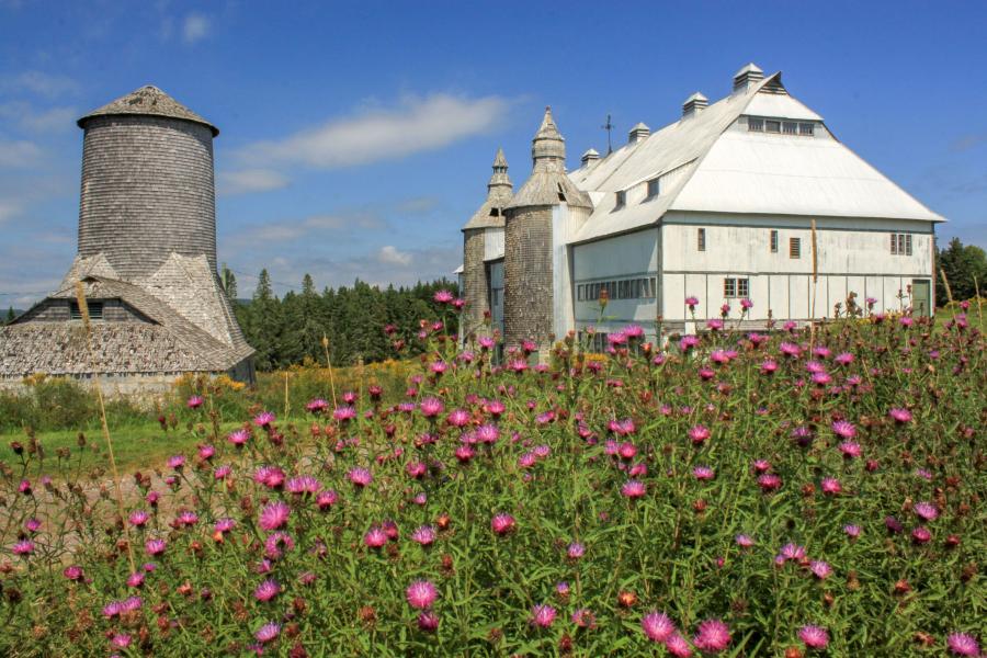
Travel back in time to the early 1900s, when trains were the primary mode of travel and railway barons got rich building railways. William Van Horne was one of those barons. Over a 35-year period he purchased all the land on Ministers Island. He and his family built a summer home (a mansion by most people’s standards) and European-inspired barns for his prized Dutch belted cattle. The cattle were his hobby when he wasn’t building railways.
Check out the small cottage near the barn and be transported back even further to the late 1700s. At this time the island was owned by Reverend Andrews, for which the Island got its name.
If you go back even further still, to a time when canoes were the main mode of travel, the Passamaquoddy First Nations used this island as an important summer camp. Archaeological digs on the island have found remnants of these sites dating back 2500 years.
As you walk around the perimeter of Ministers Island on old carriage roads, through grassy fields, you will find many layers of history. Make sure you plan your trip accordingly since the island is only accessible at low tide. Explore all the trails but don’t linger too long on the island or you will have to wait an additional 8 to 10 hours until the next low tide.
10. HOPEWELL ROCKS PARK
More than 250,000 people visit The Hopewell Rocks between June and September. In August, that’s an average of over 3,000 people per day. Most of the visitors come to the park to explore the beach around the flowerpot rocks, an amazing display of the tidal forces in the Bay of Fundy. A trail by the Visitor Centre will take you to the much quieter Demoiselles Beach. This long sandy beach is separated from the rest of the park by the rocky cliff formations. Shepody Mountain looms on the horizon in the other direction.
Although Demoiselles Beach Trail is much quieter, but you should still definitely visit the beach around the flowerpot rocks on your visit. I would suggest visiting them before your hike to Demoiselles Beach and again afterwards to get a sense of how fast these tides rise and fall. Note that the flowerpot rocks are under water at high tide so plan your visit accordingly.
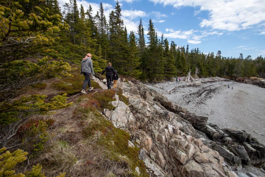
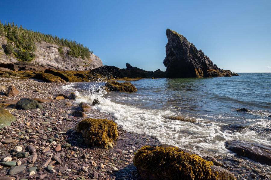
11. SPLIT ROCK
Leave the hustle and bustle of Saint John behind as you take the short drive to Lorneville. When you pass through the Coleson Cove power plant, you may question what kind of hiking trail you will find, but you won’t be disappointed. Take a short walk on an old road and you will come to a lookout platform that looks like it should be condemned (and it probably should be). The platform overlooks the power plant and the rocky shoreline. Follow the trail around the corner and you will leave civilization behind. Continue along the rocky clifftops, making sure to check out all the side trails to lookouts. The black and gray rocky cliffs, and the waves crashing below, reminded me of the Lighthouse Trail on Grand Manan, but this trail is much easier to get to.
At about halfway you will find Split Rock. Don’t follow the small trail by the sign that points to split rock like I did. The sign points to Split Rock out in the bay and the trail is just a way to get better views. Just past Split Rock you will find views across an inner bay. Look closely and you will see the Musquash Head Lighthouse in the distance. If you are adventurous, you can climb down into a large crack in the earth with the help of a rope that someone left. If you do, be extremely careful and make sure someone stays out of the crack just in case.
Each time you see the lighthouse through the trees it will get larger, like a tall, white giant playing peek-a-boo. Eventually you will come out to the grassy area around the lighthouse. The views of the Bay of Fundy from this point at the mouth of the Musquash Estuary are spectacular. If you are still feeling adventurous, you can continue for another 12 kilometres along the shores of the estuary on Troy’s Trail, Black Beach Trail, Lorneville Link, and the Five Fathom Hole Trail.
Split Rock Trail is a spectacular coastal trail that is easy to access, but still spectacular.
12. WILLIAMS TRAIL
Williams Trail starts at Cape Spencer Lighthouse on an amazing point of land overlooking the Bay of Fundy. The trail drops down towards the bay through a field before entering the thick forest. The turquoise waters of the bay blend with the surrounding grass and trees.
The trail climbs up and down along the coastline and provides the most spectacular views. There are many side trails that go out to lookouts, usually on narrow rocky ridges so use caution. In a few places there are ropes to help you up steep sections of trail.
The trail passes by Ploughshare rock, a large rocky outcrop just offshore. Another side trail takes you down to Shark Rock Beach where you will find a large pointy rock that looks like a giant shark fin sticking out of the water near the beach.
At the 3-kilometre mark there is one last lookout before you have to return the way you came.
🌊 🌊 🌊
There is something deep in us that draws us to the ocean. The waves lapping on the beach or crashing on the rocks. These places are made to slow down. Take it all in. What better way than to take a walk through a foggy spruce forest or just out of reach of the waves on a sandy beach. Close your eyes, breathe deep, and you will find magic.
Hope to see you on the trail!
🚶 🚶 🚶